
Arizona recorded 1,178 traffic fatalities in 2023, placing it among the highest per-capita fatality rate states in the western United States at 1.54 deaths per 100 million vehicle miles traveled. Intersection accidents in Phoenix and Tucson account for a disproportionate share of that total.
ADOT’s fatal accident location mapping shows that 43 percent of urban fatal crashes occur at or within 250 feet of a signalized intersection. This proportion is higher than the national average of 36 percent and reflects specific intersection design and traffic signal timing challenges in high-growth corridors.
How Phoenix’s Road Network Design Affects Collision Frequency
Phoenix’s arterial grid, characterized by high-speed multi-lane roads spaced roughly one mile apart, creates intersection environments where turning conflicts occur at speeds significantly higher than the national norm. The combination of 45 to 55 mile-per-hour through-traffic speeds and large intersection dimensions extends clearing distances for pedestrians and cyclists.
The Valley’s pedestrian fatality rate of 4.1 per 100,000 residents significantly exceeds the national average of 2.3 per 100,000, reflecting both road network design and high summer temperatures that concentrate pedestrian activity in lower-visibility periods.
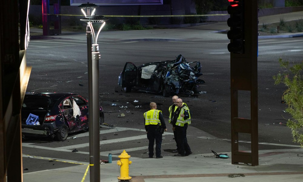
What Red Light Running Data Reveals About Arizona Crash Causes
Arizona recorded 11,238 red-light-running crashes in 2023, a 14 percent increase from the 2019 baseline. Several high-collision intersections in Maricopa County have been identified for automated enforcement camera installation. Tracking these developments through consistent Arizona car accident reporting provides the contextual awareness needed to understand how specific corridors are evolving in terms of collision risk and regulatory response.
How Freeway Collision Patterns Differ From Urban Intersection Data
Arizona’s Interstate 10 corridor through Phoenix and I-17 north of the city show collision patterns dominated by rear-end events and lane-change crashes. Speed differential between through-traffic and merging vehicles is the primary contributing factor identified in freeway collision investigations.
The stretch of I-10 between Phoenix and Tucson is one of the most statistically dangerous freeway segments in the state, combining high commercial truck volume with a long flat alignment that contributes to driver inattention.
What Infrastructure Investment Is Addressing in Arizona
Arizona received approximately $297 million in federal safety formula funding in fiscal year 2024, with priority allocations toward high-injury network improvements, cable median barrier expansion, and targeted intersection redesign in Maricopa and Pima counties.
Arizona’s crash data reflects challenges common to high-growth Sun Belt metropolitan areas: rapid population expansion, legacy road network designs not optimized for current traffic volumes, and pedestrian infrastructure gaps in suburban corridors. Understanding these patterns in specific geographic terms is essential for residents and professionals who need more than statewide summaries.